OUR SERVICES
Geoscience Services Built for Confident Decisions
Nine specialized service groups covering every stage of geological investigation, mapping, exploration, and technical advisory.
Independent or Integrated.
Flexible by Design.
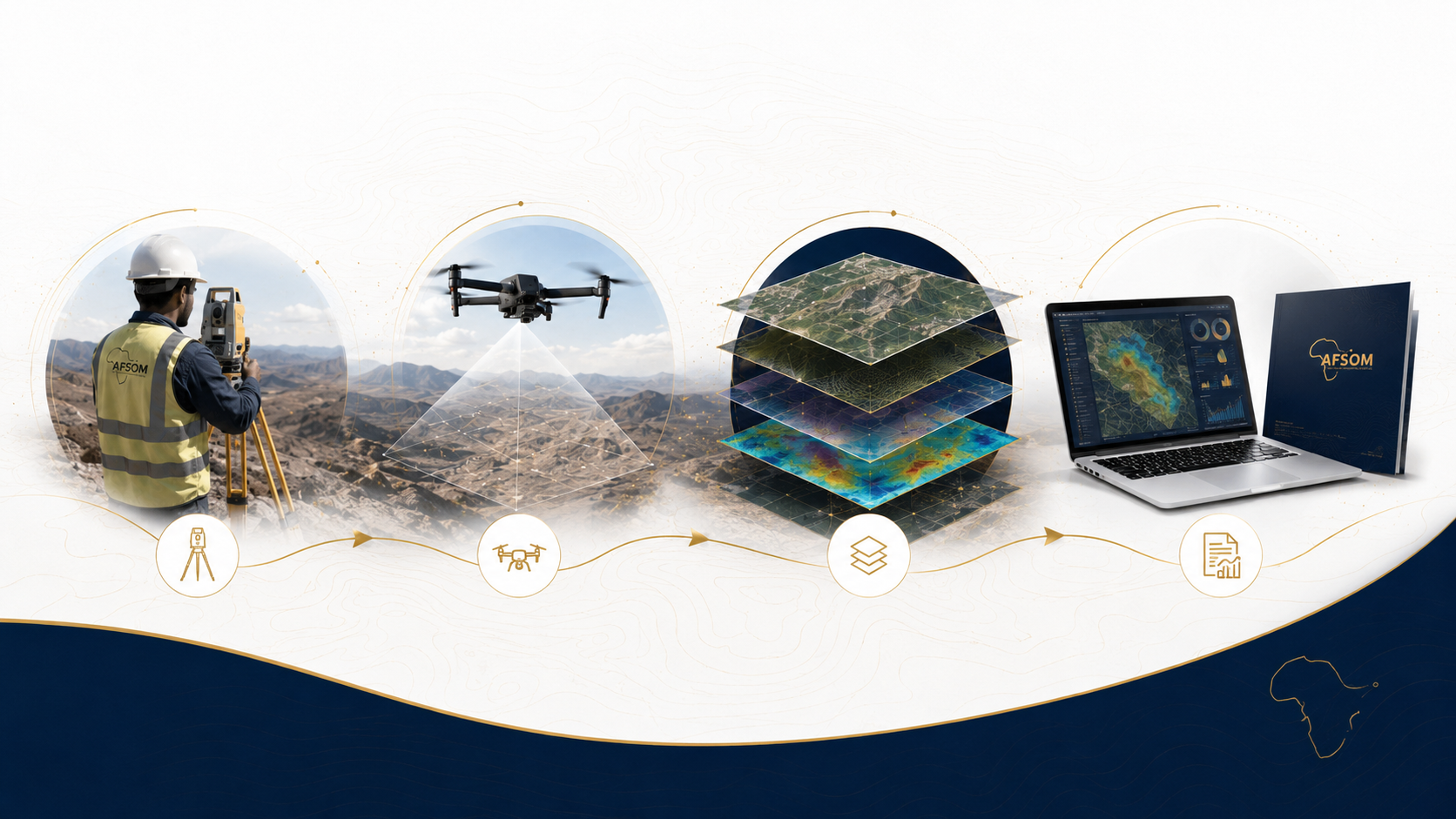
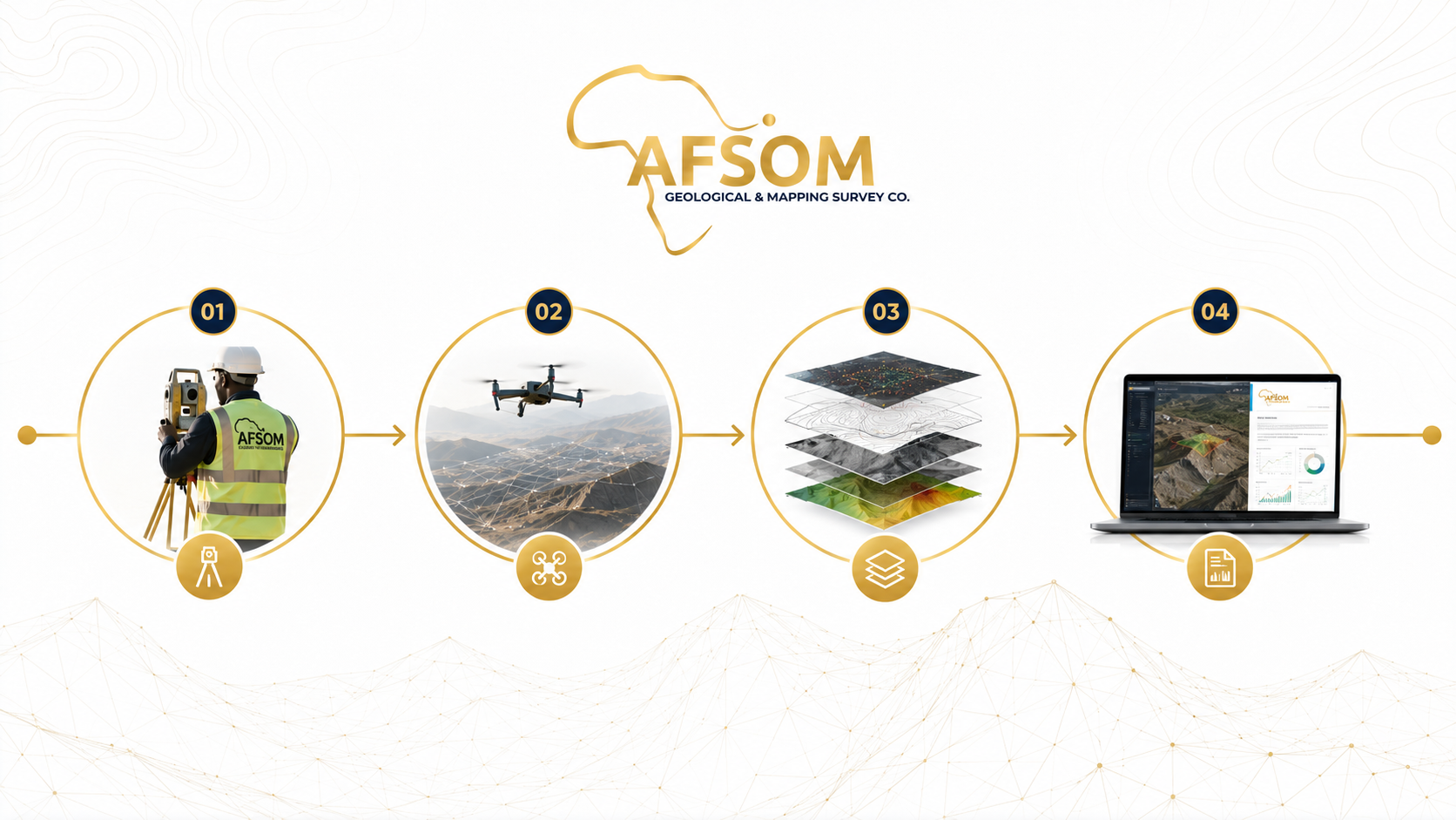
From initial geological reconnaissance through to detailed technical reporting and strategic advisory, AFSOM provides comprehensive services that support every phase of mineral exploration, infrastructure development, and natural resource management.
Our service groups are designed to work independently or as integrated programs, giving you the flexibility to engage exactly what your project requires.
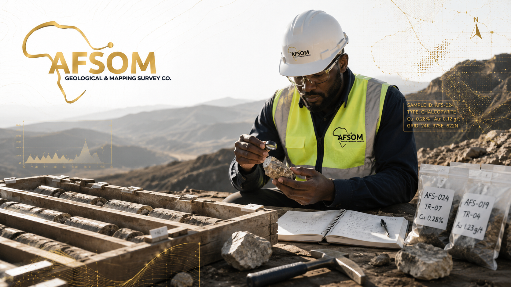
Geological Survey Services
Geological surveys form the foundation of informed decision-making in mining, infrastructure, and land development. AFSOM conducts systematic field-based geological assessments that document rock types, structures, mineral occurrences, and surficial materials. Our surveys provide the essential baseline data required for resource estimation, engineering design, environmental assessment, and exploration targeting. Each survey is tailored to the project's scale and objectives, ensuring that clients receive relevant, high-quality geological information.
The Challenge
Operating in regions with limited existing geological data creates significant uncertainty for project planners, investors, and developers. Without reliable baseline geology, organizations face increased risk of unexpected ground conditions, misallocated exploration budgets, poor siting decisions, and regulatory delays. In Somaliland and the Horn of Africa, the scarcity of published geological maps and datasets means that every project requires dedicated field investigation to establish a credible geological foundation.
How We Help
AFSOM bridges the geological data gap by deploying qualified geologists to conduct rigorous field surveys using industry-standard methodologies. We systematically map, sample, and document geological features, then process and interpret the data to produce clear, actionable geological reports and maps. Our team's regional expertise ensures that field observations are placed in proper geological context, while our commitment to quality control guarantees reliable, defensible results.
Scope of Work
- Desktop review of existing geological literature, maps, and remote sensing data prior to field deployment
- Field reconnaissance to establish geological context, access conditions, and key outcrop locations
- Systematic rock and soil sampling following standardized protocols and chain-of-custody procedures
- Structural measurements including bedding orientations, joint sets, fault characteristics, and fold geometry
- Identification and documentation of mineral occurrences, alteration zones, and economic mineral indicators
- Geological interpretation integrating field observations with regional tectonic and stratigraphic frameworks
- Digital data capture using field tablets and GPS-enabled devices for seamless GIS integration
Geological Mapping
Geological mapping translates complex field observations into clear, spatially accurate representations of the Earth's surface and subsurface. AFSOM produces detailed geological maps at scales appropriate to project requirements, from regional reconnaissance to prospect-scale detail. Every map integrates lithological boundaries, structural features, alteration patterns, mineralization indicators, and topographic context into a unified cartographic product that serves as an essential tool for exploration, planning, and development.
The Challenge
Accurate geological maps are critical for mineral exploration, infrastructure planning, and land-use decisions, yet many regions of Somaliland and the Horn of Africa lack modern, reliable geological cartography. Outdated or non-existent maps lead to inefficient exploration programs, misinformed investment decisions, and increased geological risk. Producing high-quality geological maps requires skilled field geologists, modern GIS technology, and rigorous quality assurance throughout the mapping workflow.
How We Help
AFSOM combines systematic field mapping with modern GIS and remote sensing technology to produce accurate, publication-quality geological maps. Our geologists capture field observations digitally, integrate multiple data layers, and apply rigorous cartographic standards to deliver maps that are both scientifically robust and visually clear. Every map is accompanied by explanatory notes and cross-sections that make the geological information accessible to technical and non-technical stakeholders alike.
Scope of Work
- Reconnaissance mapping at regional to district scales to establish broad geological frameworks
- Detailed prospect-scale mapping for mineral exploration and resource evaluation projects
- Structural mapping documenting fold geometry, fault networks, and kinematic indicators
- Lithological mapping delineating rock unit boundaries, facies changes, and stratigraphic relationships
- Alteration mapping identifying hydrothermal alteration zones, weathering profiles, and geochemical halos
- Mineralization mapping recording mineral occurrences, vein systems, and ore mineral distribution
- GIS-based digital mapping with attribute-rich spatial databases for analysis and integration
- Construction of geological cross-sections illustrating interpreted subsurface geometries
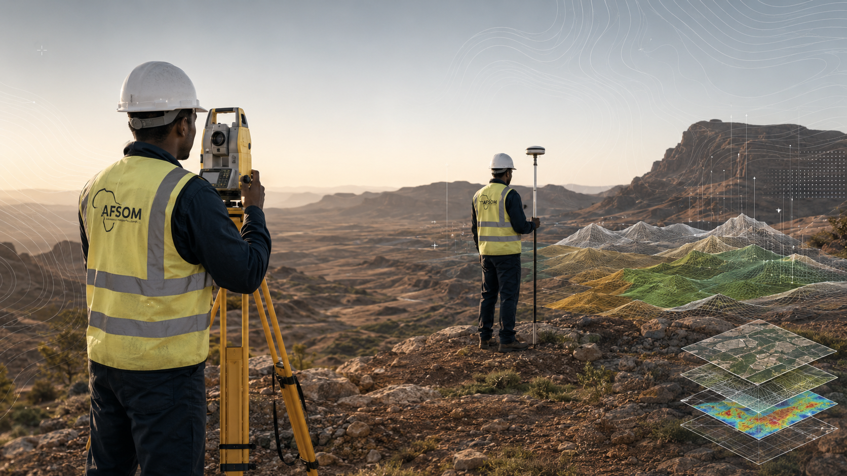
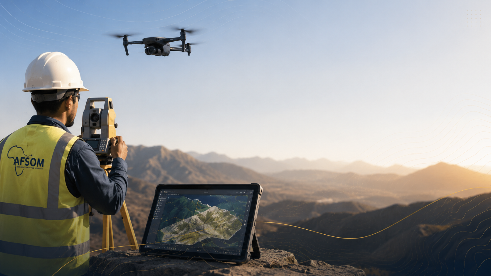
Topographic Mapping
Accurate topographic data is essential for engineering design, construction planning, resource estimation, and environmental management. AFSOM provides comprehensive topographic mapping services using both traditional survey methods and modern geospatial technology. From regional terrain models to detailed site surveys, our topographic products deliver the precision and reliability that infrastructure, mining, and development projects demand.
The Challenge
Many project sites in Somaliland and the Horn of Africa lack reliable topographic data at the resolution required for detailed engineering and planning work. Using coarse or outdated elevation data can lead to design errors, inaccurate earthwork estimates, drainage problems, and costly construction modifications. Obtaining accurate topographic information requires trained survey crews, calibrated equipment, and systematic data collection and processing procedures.
How We Help
AFSOM deploys experienced survey teams equipped with GNSS receivers, Total Stations, and UAV platforms to capture high-resolution topographic data tailored to each project's accuracy requirements. We process field measurements using industry-standard software to produce contours, digital terrain models, and site plans that form a reliable foundation for engineering design and volumetric analysis. Our quality control procedures ensure that delivered products meet or exceed project specifications.
Scope of Work
- Establishment of survey control networks using high-precision GNSS observations
- Detailed topographic pickup using Total Station and GNSS rover techniques
- UAV-based photogrammetric surveys for medium to large area coverage with high point density
- Contour generation at specified intervals with breakline enforcement for terrain definition
- Production of Digital Terrain Models and Digital Elevation Models in standard industry formats
- Site layout plans showing built features, boundaries, access routes, and key infrastructure
- Volume calculations for stockpiles, excavations, cut-and-fill, and resource estimation
- Engineering survey support including setting-out data, as-built surveys, and deformation monitoring
Remote Sensing
Remote sensing provides a powerful synoptic perspective for geological assessment, environmental monitoring, and land-use analysis. AFSOM leverages satellite imagery, aerial photography, and UAV platforms to extract meaningful information about terrain, geology, vegetation, and surface conditions across scales ranging from regional reconnaissance to detailed site investigation. Our remote sensing services complement ground-based surveys, enabling more efficient targeting and broader contextual understanding.
The Challenge
Ground-based geological and environmental surveys are essential but can be time-consuming and expensive, particularly for large or inaccessible areas. Organizations need efficient methods to prioritize field efforts, identify targets, and monitor change over time. Interpreting remote sensing data requires specialized expertise in image processing, spectral analysis, and geological feature recognition that may not be available within client organizations.
How We Help
AFSOM applies professional remote sensing analysis techniques to extract geological, structural, and environmental information from satellite and aerial imagery. Our team processes multispectral and radar data to identify lithological boundaries, alteration patterns, structural lineaments, and land-cover changes. UAV-based surveys provide high-resolution imagery and terrain data for detailed site-scale mapping. We integrate remote sensing interpretations with field validation to produce reliable, ground-truthed products.
Scope of Work
- Multispectral satellite imagery acquisition, processing, and geological interpretation
- Structural lineament extraction and analysis for regional tectonic and exploration targeting
- Alteration mineral mapping using spectral indices and band ratio techniques
- Land-cover classification and vegetation mapping for environmental baseline studies
- Change detection analysis comparing multi-temporal imagery to identify surface modifications
- UAV-based aerial survey planning, execution, and orthophoto production
- Target identification and prioritization to guide ground-based exploration programs
- Environmental mapping including surface water, erosion, and land degradation assessment
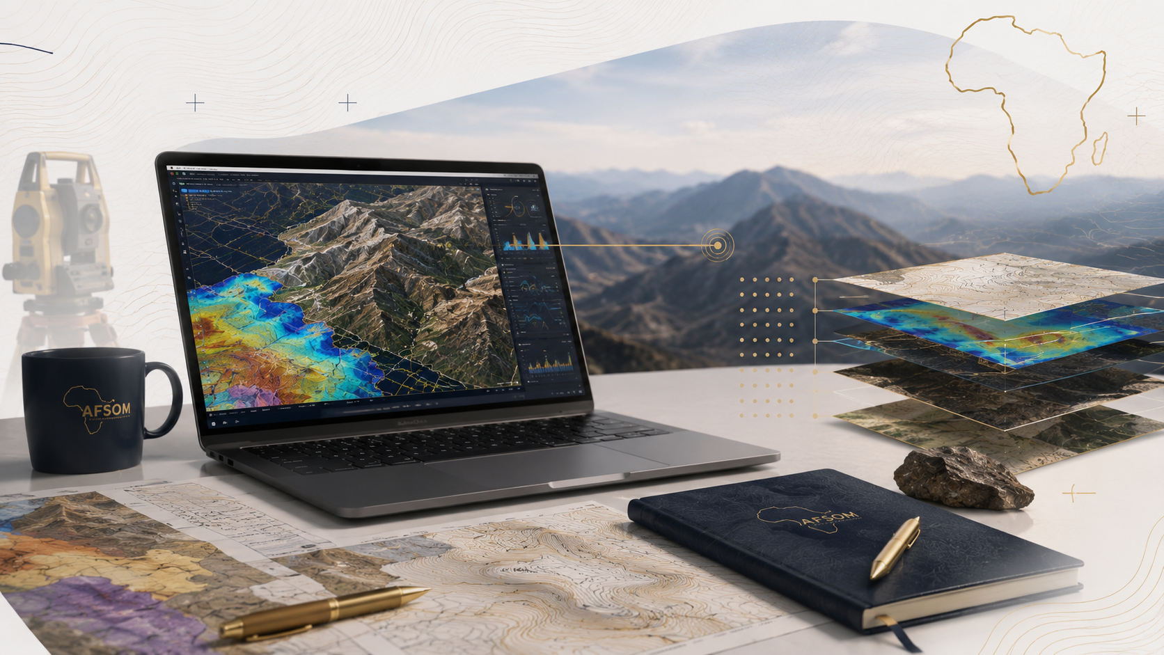
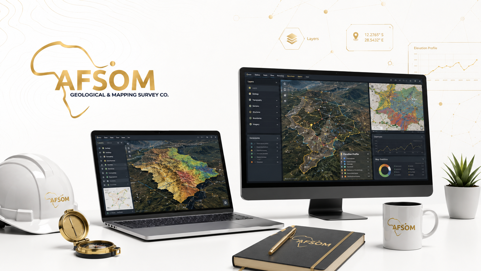
GIS and Digital Mapping
Geographic Information Systems transform raw spatial data into organized, queryable, and visually compelling information products. AFSOM designs and builds GIS databases, performs spatial analysis, and produces digital maps and dashboards that make geological and survey data accessible and actionable. Our GIS services ensure that project data is properly structured, documented, and maintained for ongoing use beyond the immediate project lifecycle.
The Challenge
Geological and survey projects generate large volumes of spatial data in diverse formats from multiple sources. Without proper data management, this information becomes fragmented, difficult to access, and vulnerable to loss. Organizations struggle to integrate field observations, laboratory results, remote sensing data, and existing datasets into a coherent spatial framework that supports analysis and decision-making. Poor data management practices undermine the long-term value of project investments.
How We Help
AFSOM provides comprehensive GIS and data management services that organize, integrate, and visualize spatial information. We design geodatabase schemas, implement data quality controls, perform spatial analyses, and produce professional digital maps and interactive dashboards. Our approach ensures that data is well-documented, easily retrievable, and structured to support both immediate project needs and long-term organizational knowledge management.
Scope of Work
- Design and implementation of GIS geodatabases with appropriate feature classes, attribute tables, and domains
- Integration of field survey data, laboratory results, remote sensing interpretations, and existing datasets
- Spatial data management including metadata creation, version control, and backup procedures
- Digital map production with professional cartographic styling, legends, and coordinate systems
- Spatial analysis including proximity, overlay, terrain, and statistical operations
- Development of interactive dashboards for data visualization and query
- Production of thematic maps highlighting specific geological, geochemical, or geophysical themes
- GIS training and knowledge transfer to build client capacity for ongoing data use and maintenance
Land and Mineral Surveys
Land and mineral surveys provide the legal, spatial, and geological information needed for mineral rights management, land-use planning, and resource development. AFSOM conducts cadastral support surveys, mineral occurrence investigations, area verification, and target evaluations that help clients establish tenure, assess potential, and make informed land-use decisions. Our survey documentation meets regulatory requirements and professional standards.
The Challenge
Establishing secure land and mineral tenure, verifying area extents, and evaluating mineral potential require survey work that combines legal, spatial, and geological expertise. In regions where cadastral records are incomplete or disputed, and mineral occurrence data is sparse, organizations face elevated risk of boundary disputes, invalid tenure applications, and missed mineral opportunities. Professional survey support is essential to navigate these challenges.
How We Help
AFSOM provides integrated land and mineral survey services that address both spatial-legal requirements and geological assessment needs. Our surveyors establish accurate boundaries and compile survey documentation for tenure applications, while our geologists investigate mineral occurrences and evaluate targets. This combined approach ensures that clients have reliable spatial information and geological context for their land and mineral assets.
Scope of Work
- Cadastral survey support including boundary demarcation, coordinate determination, and survey plan preparation
- Mineral occurrence investigation through field examination, sampling, and preliminary assessment
- Area verification surveys to confirm extent, accessibility, and physical characteristics of license areas
- Target evaluation combining geological observations with remote sensing and geochemical data
- Survey documentation preparation in accordance with applicable regulatory requirements
- Land-use assessment identifying constraints, sensitivities, and development opportunities
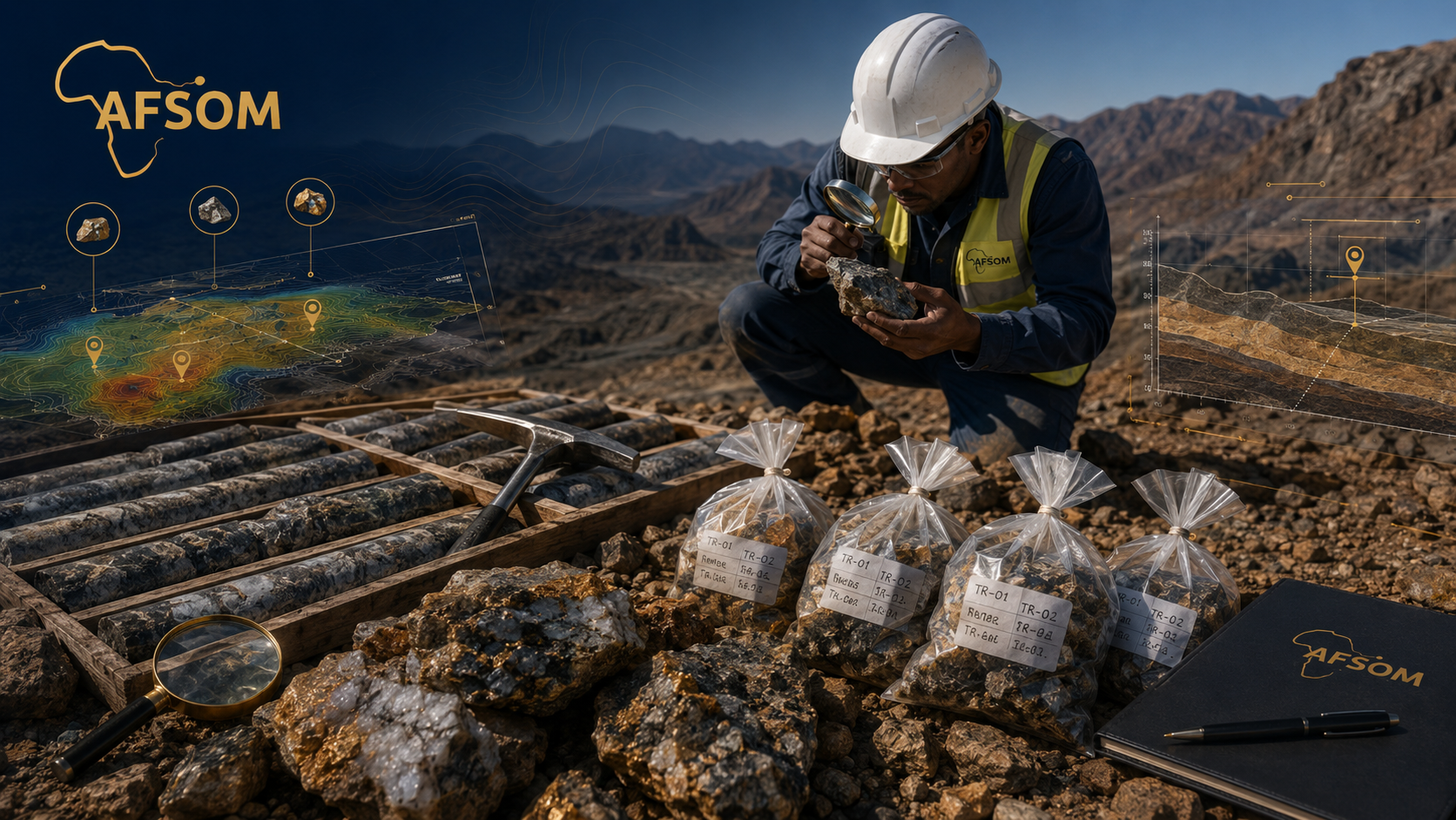
Mineral Exploration
Mineral exploration is a systematic process of searching for economically viable mineral deposits. AFSOM provides comprehensive exploration services spanning early-stage prospect generation and reconnaissance through to advanced target definition, sampling, trenching, and drilling support. Our exploration programs are designed to progressively reduce geological uncertainty while managing costs, enabling clients to make informed decisions about advancing or relinquishing exploration properties.
The Challenge
Mineral exploration is inherently high-risk and capital-intensive. Success requires methodical application of geological knowledge, systematic data collection, and disciplined decision-making at each stage of the exploration pipeline. In underexplored regions like Somaliland, the absence of historical exploration data means that programs must start from fundamentals, requiring skilled geologists who understand both regional metallogeny and practical exploration techniques.
How We Help
AFSOM designs and executes staged mineral exploration programs that systematically progress from regional target generation to detailed deposit evaluation. Our approach applies established exploration methodologies adapted to local geological conditions, with clear stage gates, defined success criteria, and rigorous quality control. We work closely with clients to align exploration strategy with business objectives, budget constraints, and risk tolerance.
Scope of Work
- Prospect generation through compilation and interpretation of geological, geochemical, and geophysical data
- Regional and district-scale reconnaissance surveys to identify and prioritize mineral occurrences
- Target definition through detailed geological mapping, geochemical sampling, and geophysical surveys
- Systematic field sampling including rock chip, soil, stream sediment, and channel sampling programs
- Trenching programs designed to expose bedrock, map mineralization, and collect channel samples
- Pit mapping to document wall-rock geology, mineralization style, alteration, and structural controls
- Drilling program support including drill-hole planning, geological logging, sampling, and core management
- Resource assessment support providing geological data and interpretations for resource estimation studies
- Exploration planning and strategy development for multi-year exploration campaigns
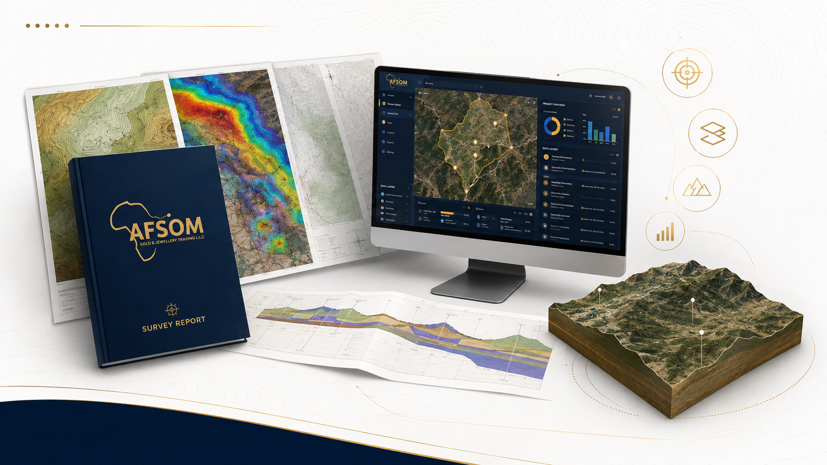
Technical Reporting
Professional technical reports translate geological data and analysis into clear, authoritative documents that support decision-making, regulatory compliance, and investment evaluation. AFSOM produces a wide range of technical reports following international reporting standards and best practices. Each report is structured to communicate complex geological information in a format that is accessible to technical specialists, management, investors, and regulatory authorities.
The Challenge
Technical reports are often the primary deliverable that clients, investors, and regulators rely upon to make critical decisions. Poorly structured reports, incomplete data presentation, or unclear conclusions can undermine confidence, delay approvals, and lead to suboptimal decisions. Producing high-quality technical reports requires not only geological expertise but also strong writing, data visualization, and quality assurance capabilities.
How We Help
AFSOM's technical reporting service combines geological expertise with professional documentation standards. Our reports follow clear logical structures, present data accurately through tables and figures, and provide well-reasoned interpretations and recommendations. Every report undergoes rigorous internal review before delivery to ensure accuracy, completeness, and clarity. We tailor report content and format to the specific requirements of each client and the intended audience.
Scope of Work
- Geological survey reports documenting field methodology, observations, interpretations, and conclusions
- Exploration reports presenting sampling results, geological mapping, and target evaluations
- Mapping reports with accompanying maps, cross-sections, and geological descriptions
- Technical evaluations assessing mineral properties, exploration data, and development potential
- Due-diligence reviews providing independent assessment of technical data for investment decisions
- Mineral-potential assessments evaluating regional prospectivity for specific commodities
- Management summaries distilling technical information into concise briefings for executive audiences
- Report formatting and production including figures, tables, appendices, and professional layout
Mining Consultancy
Mining consultancy bridges the gap between geological data and sound business decisions. AFSOM provides strategic advisory services that help clients evaluate mineral opportunities, design exploration programs, assess project risks, and make informed investment choices. Our consultants bring practical mining industry experience combined with deep regional geological knowledge to deliver advice that is technically sound and commercially relevant.
The Challenge
Mineral sector decisions involve substantial financial commitments and complex technical considerations. Investors, developers, and government agencies often need independent technical advice to evaluate opportunities, assess risks, and plan effectively. Navigating the technical, regulatory, and commercial dimensions of mining projects requires multidisciplinary expertise that combines geology, engineering, finance, and local knowledge.
How We Help
AFSOM's mining consultancy service provides independent, objective technical advice tailored to each client's situation. Whether the need is for project evaluation, exploration strategy, technical review, or investment support, our consultants deliver clear, evidence-based recommendations. We combine rigorous technical analysis with practical commercial awareness to help clients make confident, well-informed decisions about mineral assets and projects.
Scope of Work
- Mining project planning including scope definition, work program design, and resource allocation strategies
- Geological advisory services providing expert interpretation and guidance on geological matters
- Exploration program design with phased work plans, budget estimation, and success criteria definition
- Resource evaluation support including data review, geological modelling input, and estimation guidance
- Investment support through technical due diligence, property valuations, and opportunity assessments
- Technical review of existing data, reports, and programs to identify gaps, risks, and opportunities
- Risk assessment identifying geological, operational, regulatory, and market risks for mining projects
- Decision-support consultancy providing structured analysis and recommendations for critical project decisions
Not Sure Which Service You Need?
We'll help you scope the right program for your project.