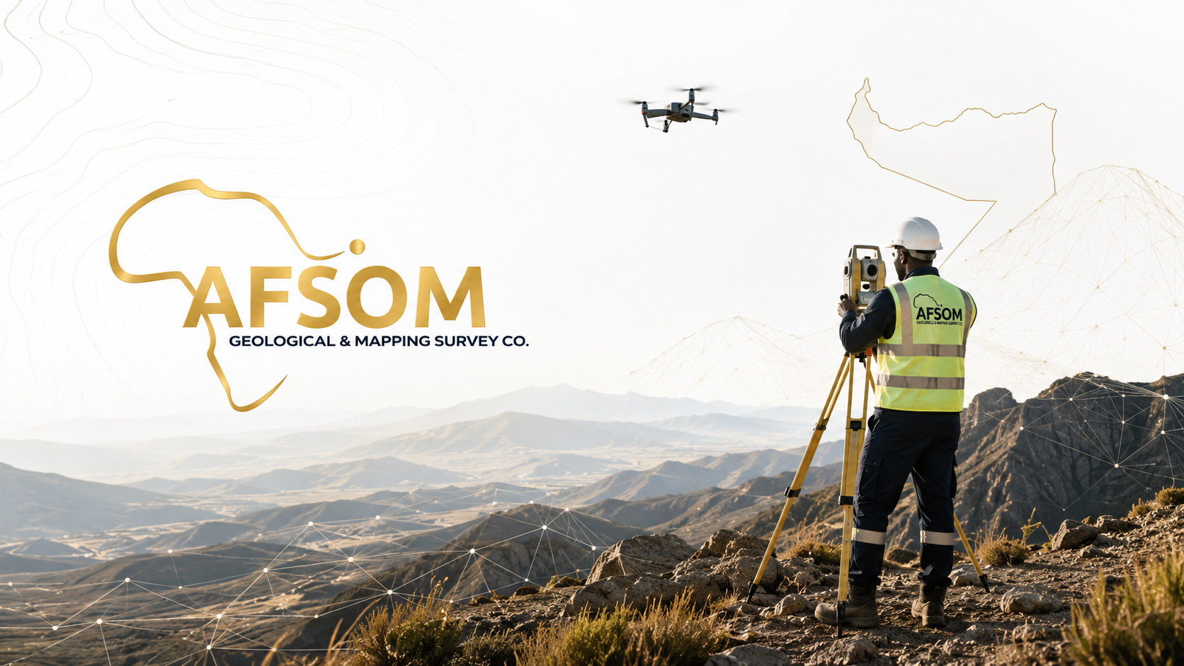
Mapping the FutureDiscovering ResourcesDelivering Confidence
AFSOM delivers professional geological surveys, mapping, mineral exploration, GIS, remote sensing, technical reporting, and advisory services designed to support confident decisions and sustainable development.

About AFSOM
Trusted Geological Insights. Professional Survey Solutions.
Professional geological and survey services delivering international standards across the Horn of Africa.
AFSOM delivers professional geological surveys, mapping, mineral exploration, GIS, remote sensing, technical reporting, and advisory services designed to support confident decisions and sustainable development.
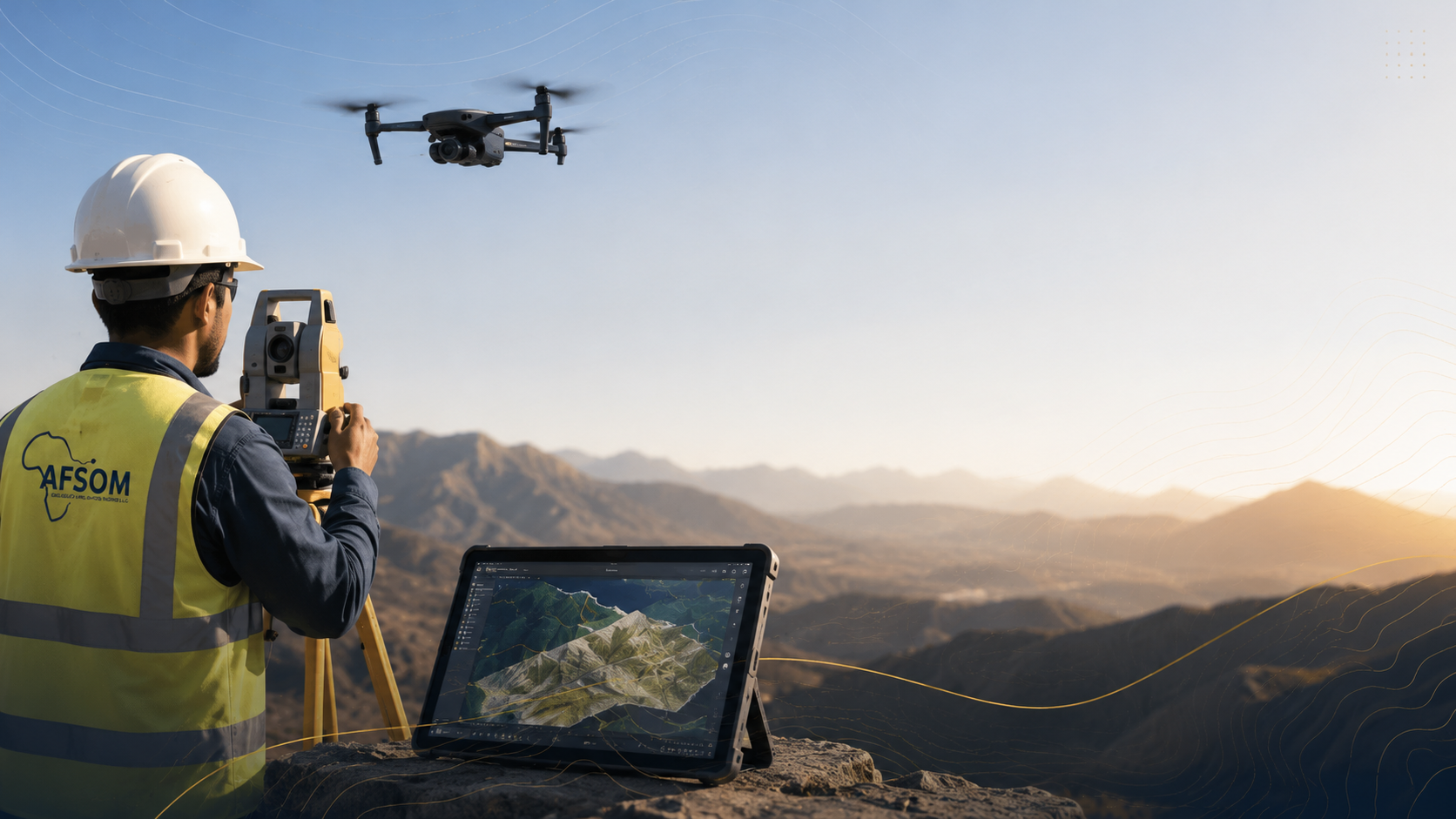
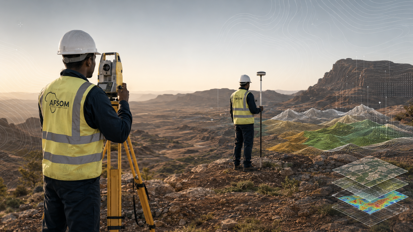
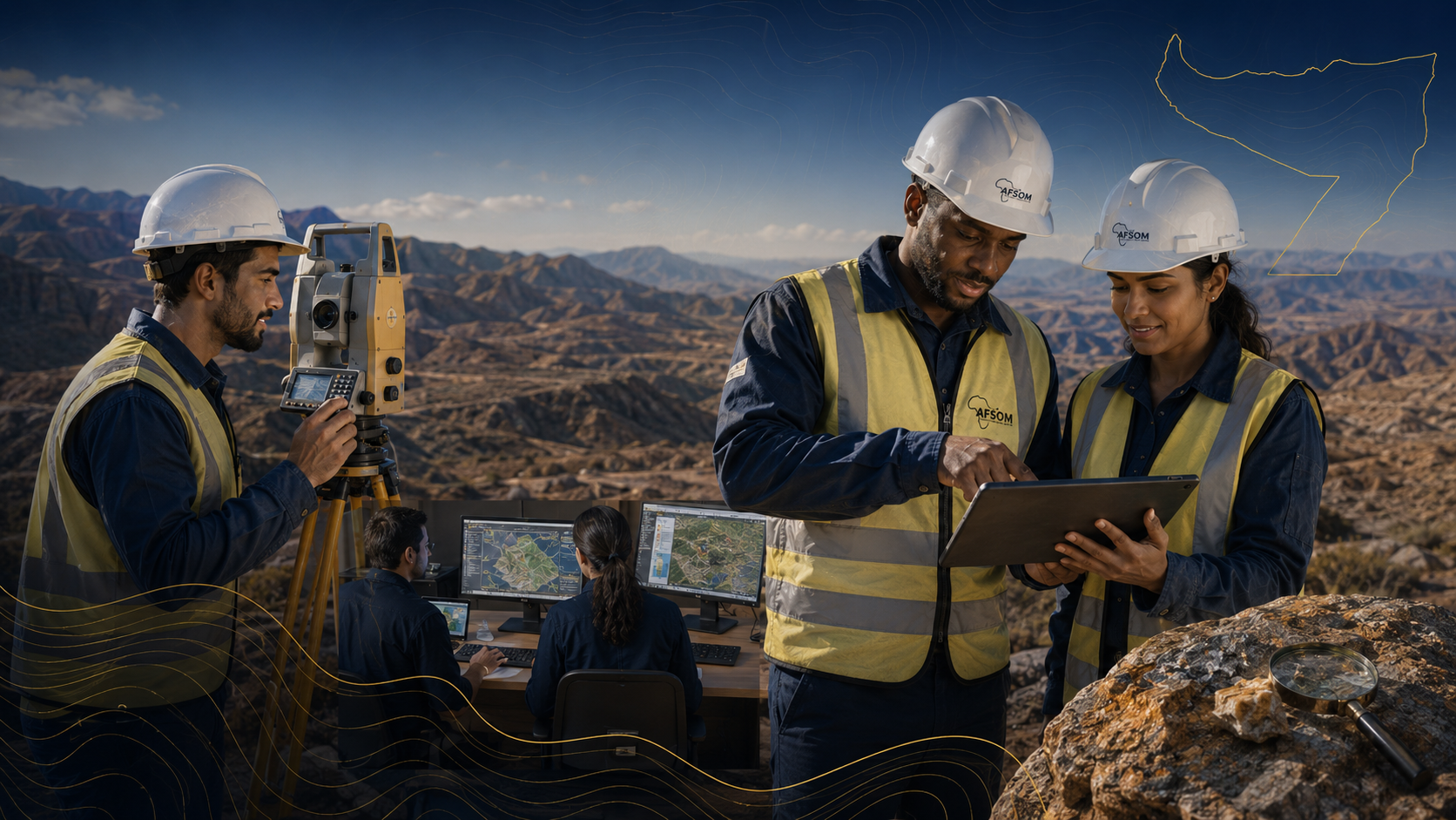
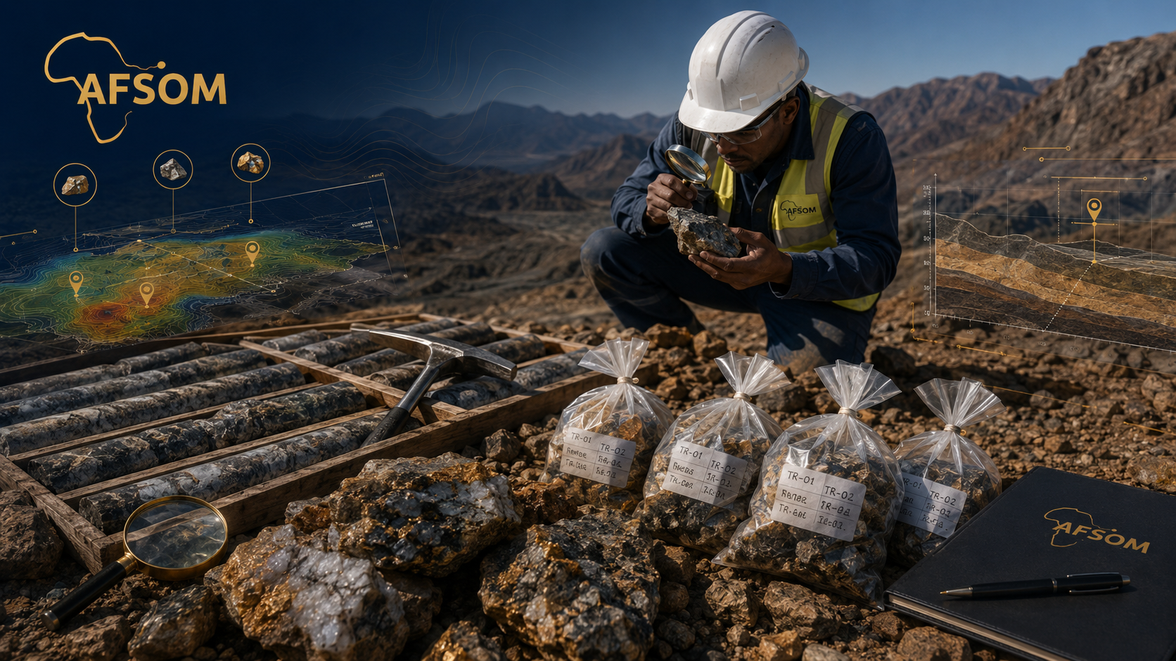
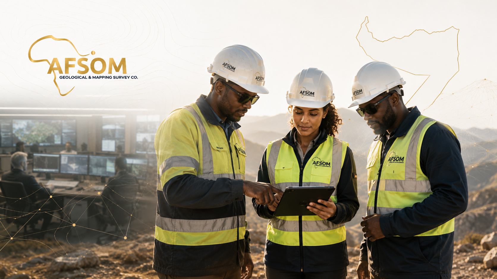
We combine local geological knowledge with modern surveying technology, systematic field methodologies, and rigorous quality control to produce reliable, actionable results for every project.
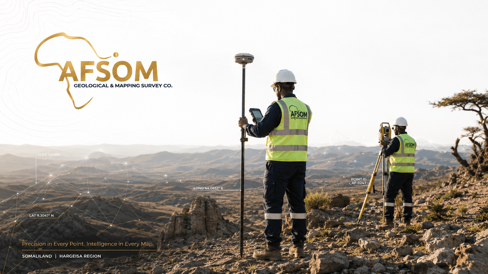
Established in 2024, AFSOM is headquartered in Dubai, United Arab Emirates with our main operational branch in Borama, Somaliland. We serve clients across Somaliland and the wider Horn of Africa region, delivering geological and mapping services that meet international professional standards.
Local Expertise
Deep understanding of Somaliland and regional geology.
Advanced Technology
Modern surveying, GIS, and remote-sensing equipment.
Reliable Data
Systematic field collection and rigorous validation.
Professional Reporting
Clear, comprehensive technical documentation.
Client-Focused Delivery
Practical solutions aligned with project objectives.
Our Core Values
Accuracy
Precision in every measurement, map, and report we produce.
Reliability
Consistent, dependable service that clients can trust.
Innovation
Embracing modern technology to improve geological understanding.
Sustainability
Supporting responsible resource development and environmental care.
Professionalism
Maintaining the highest standards in all our work.
Client Focus
Understanding client needs and delivering practical solutions.
Find the Right Service for Your Project
Answer a few questions and we will recommend the AFSOM services that best match your needs.
What type of project do you have?
What We Offer
Explore Our Services
Nine specialized service groups covering every stage of geological investigation, mapping, exploration, and technical advisory.
Pipeline
From Data to Decision
From raw geological observations to confident, actionable decisions — a systematic, quality-controlled pipeline that transforms data into insight.
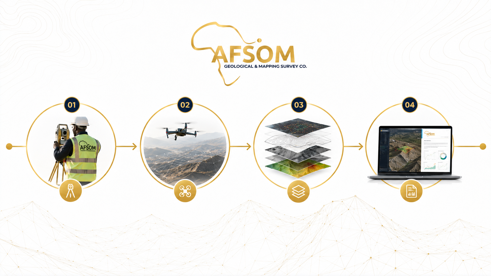
CAPTURE
Systematic collection of field observations, survey measurements, samples, and imagery using calibrated instruments and standardized protocols.
VALIDATE
Rigorous quality control checks to verify data completeness, positional accuracy, attribute consistency, and compliance with project specifications.
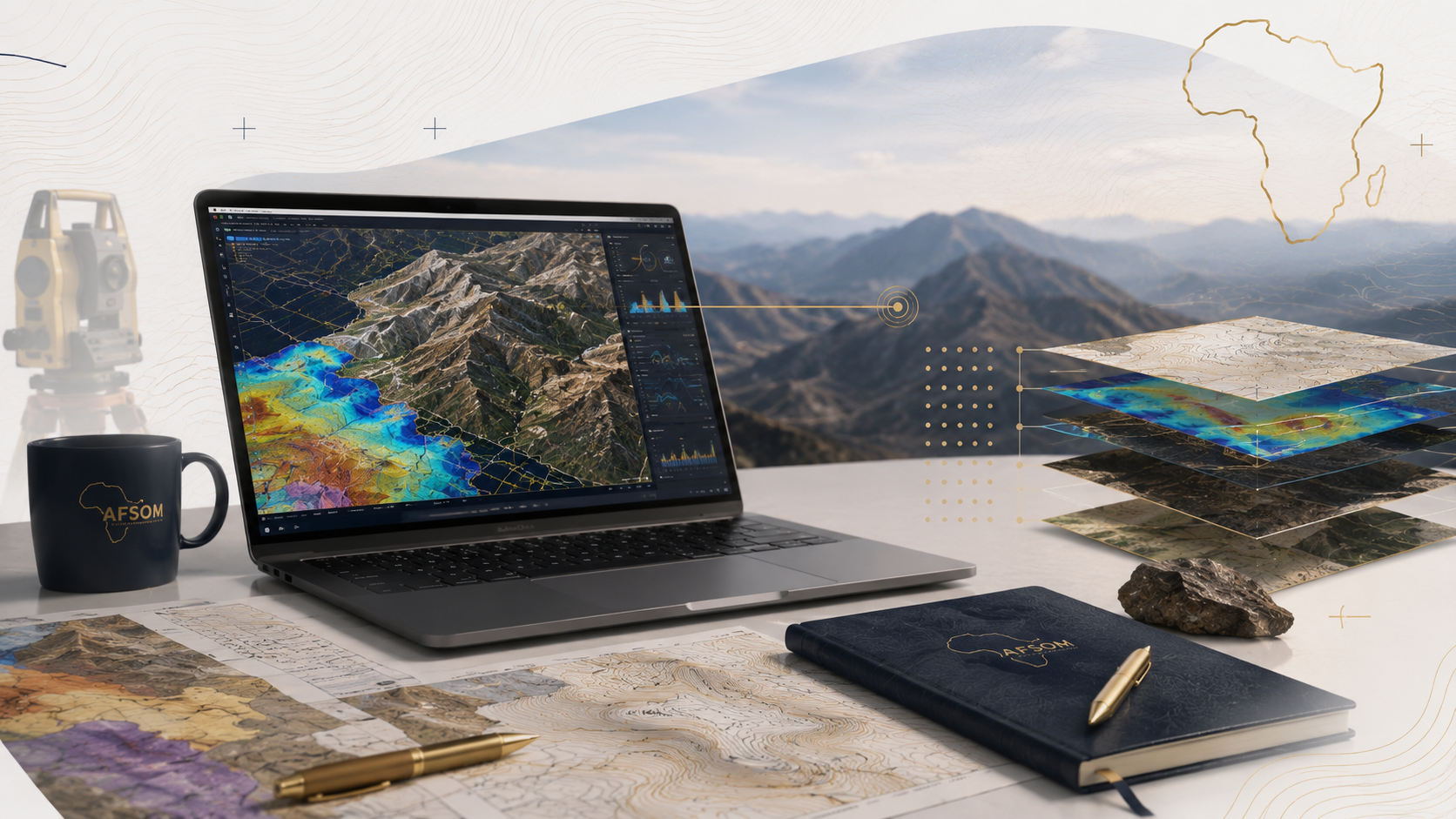
INTEGRATE
Consolidation of field data, laboratory results, remote sensing interpretations, and existing datasets into a unified geospatial database.
ANALYZE
Geological interpretation, spatial analysis, statistical processing, and modelling to extract meaningful information and insights from integrated datasets.
VISUALIZE
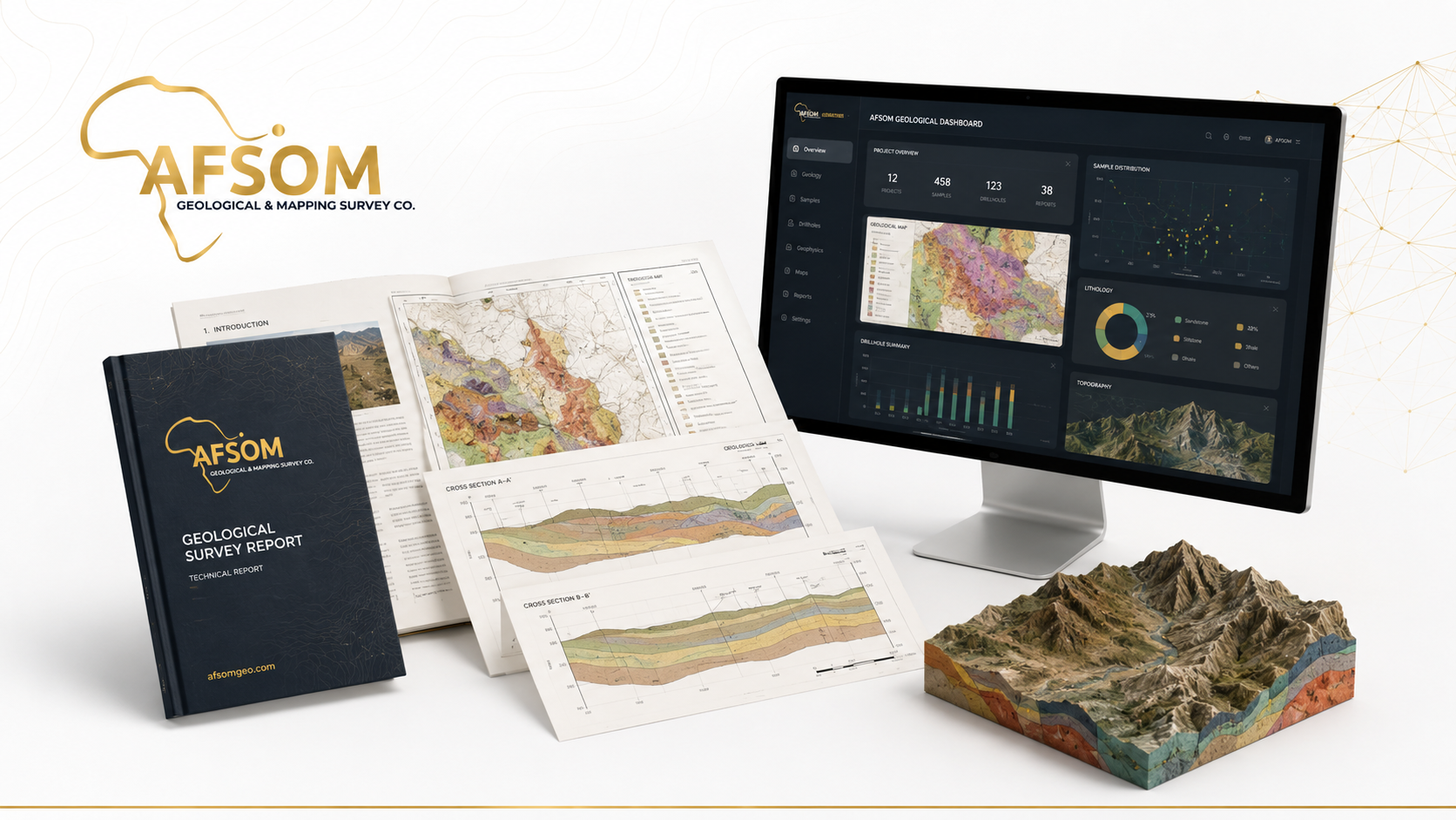
Creation of maps, cross-sections, 3D models, dashboards, and figures that communicate geological information clearly to diverse audiences.
REPORT
Compilation of findings, interpretations, and recommendations into professional technical reports that support confident decision-making.
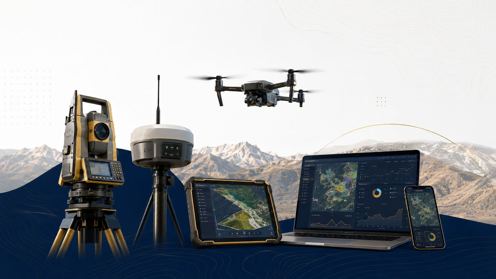
Equipment & Software
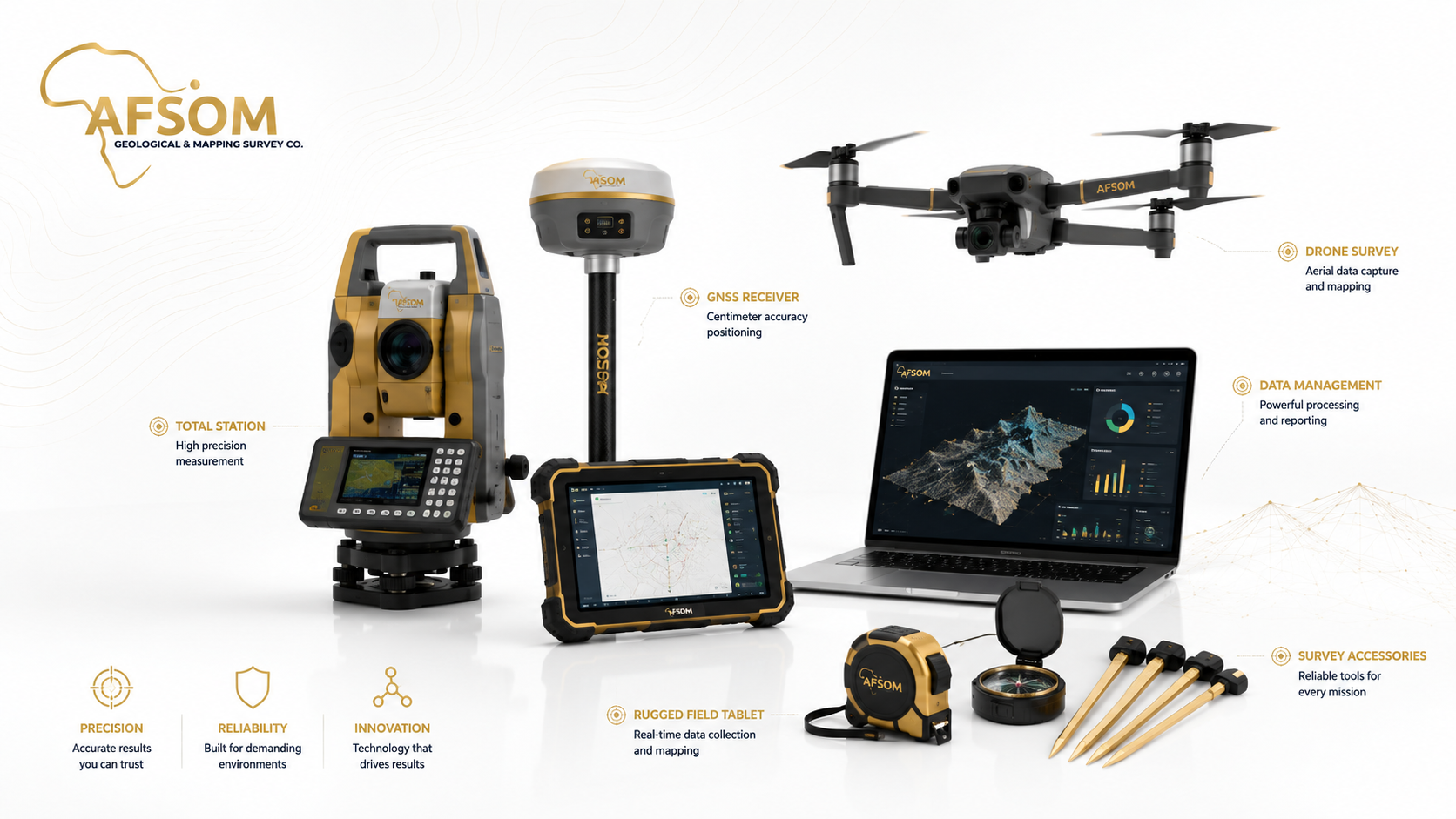
Technology That Strengthens Every Decision
Professional-grade equipment, aerial platforms, and software systems that ensure accuracy, reliability, and efficiency in every project.
Professional-grade survey and geological instruments deployed by our field teams to capture accurate, reliable measurements in diverse terrain and conditions.
Total Station
High-precision optical-electronic instrument for measuring horizontal and vertical angles and distances. Used for detailed topographic surveys, engineering set-out, control traverse, and deformation monitoring with millimeter-level accuracy.
GNSS Receivers
Multi-constellation satellite positioning receivers providing real-time and post-processed coordinate solutions. Essential for survey control establishment, topographic data capture, and sample location positioning.
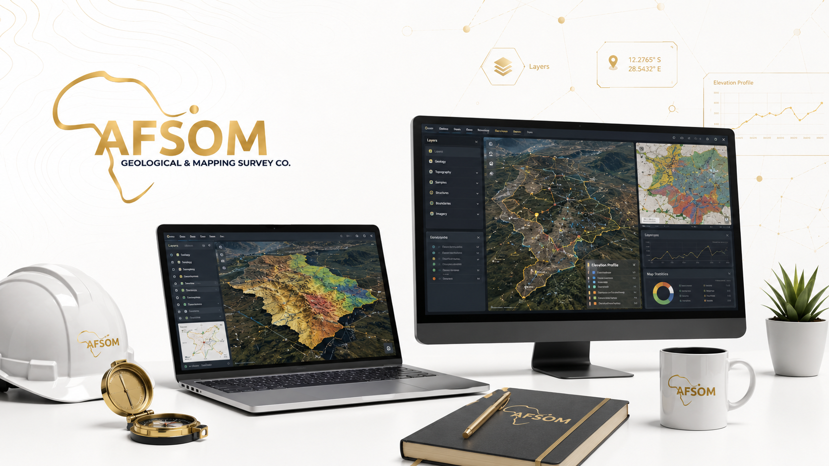
Field Tablets
Ruggedized tablet computers running mobile GIS and field data capture software. Enable real-time digital geological mapping, sample registration, photo documentation, and GPS-tagged observation recording.
Survey Accessories
Complementary field equipment supporting survey operations including tripods, prisms, leveling staffs, range poles, and measurement tapes. Ensures accurate instrument setup and target measurements.
Geological Compass
Specialized compass with clinometer for measuring planar and linear geological features. Used to record strike, dip, dip direction, plunge, and trend of bedding, foliation, joints, faults, and fold axes.
Sampling Equipment
Comprehensive geological sampling kit including rock hammers, chisels, sample bags, GPS units, field notebooks, cameras, and sample preparation tools. Supports systematic collection of representative geological samples.
GIS Layer Selector
Explore how different spatial data layers combine to create comprehensive geological maps.
Our Process
How We Deliver Every Project
A proven 8-stage methodology ensuring systematic, quality-controlled delivery from initial scoping through to final client handover.
Who We Help
Industries We Serve
From mining and infrastructure to environmental assessment and public-sector planning.

Our Commitment
Safe People. Strong Standards. Sustainable Future.
Our commitment to Health, Safety, Environment, and Quality is embedded in every project — from planning through to delivery.
Quality Assurance Workflow
Define quality requirements, standards, and control procedures specific to the project scope and deliverables.
Conduct systematic field checks, data reviews, and ongoing verification throughout the data collection phase.
Rigorously validate all data for completeness, accuracy, consistency, and compliance with project specifications.
Submit all interpretations, reports, and deliverables for independent peer review and formal approval before client delivery.
Present verified and approved deliverables to the client with full documentation and quality assurance records.
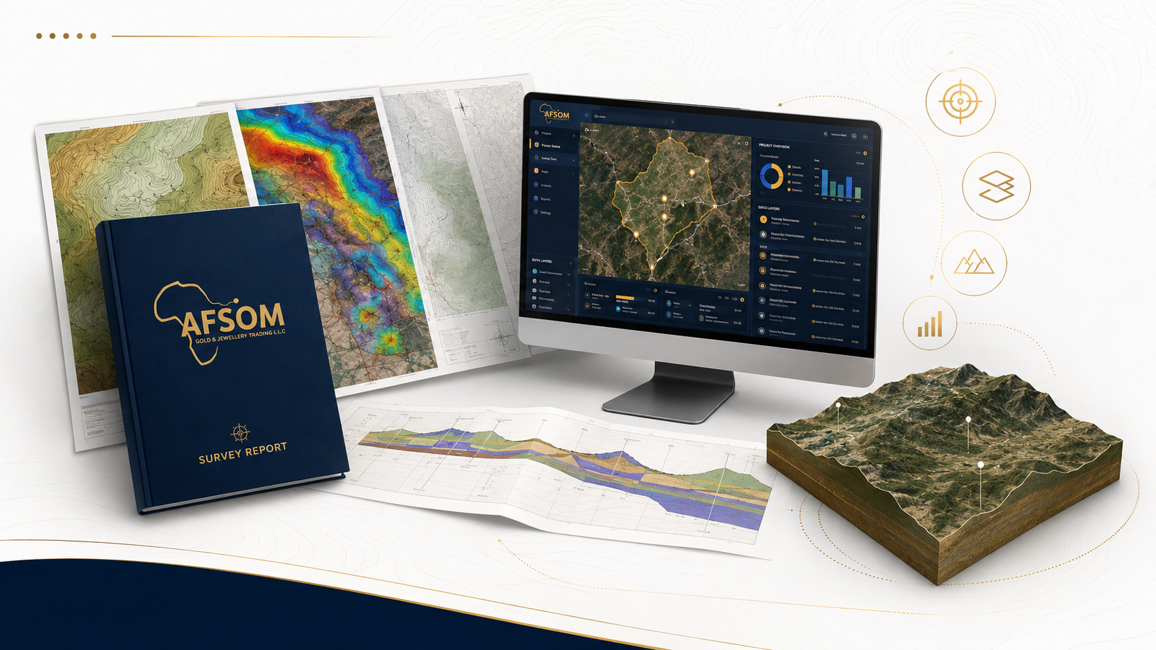
Comprehensive Deliverables
Professional geological maps, technical reports, GIS datasets, terrain models, and interactive dashboards — produced to the highest standards.
Turn Complex GroundInto Clear Direction
Whether you are exploring for minerals, planning infrastructure, developing land, or evaluating an investment — partner with AFSOM for geological insights that reduce risk and strengthen every decision.
We respond to all enquiries within two business days.