Technical Reporting
Professional technical reporting services including geological survey reports, exploration reports, mapping reports, technical evaluations, due-diligence reports, mineral-potential assessments, and management summaries.
About Technical Reporting
Professional technical reports translate geological data and analysis into clear, authoritative documents that support decision-making, regulatory compliance, and investment evaluation. AFSOM produces a wide range of technical reports following international reporting standards and best practices. Each report is structured to communicate complex geological information in a format that is accessible to technical specialists, management, investors, and regulatory authorities.
Key Service Areas:
- Geological survey reports
- Exploration reports
- Mapping reports
- Technical evaluations
- Due-diligence reports
- Mineral-potential assessments
- Management summaries
The Challenge
Technical reports are often the primary deliverable that clients, investors, and regulators rely upon to make critical decisions. Poorly structured reports, incomplete data presentation, or unclear conclusions can undermine confidence, delay approvals, and lead to suboptimal decisions. Producing high-quality technical reports requires not only geological expertise but also strong writing, data visualization, and quality assurance capabilities.
Our Solution
AFSOM's technical reporting service combines geological expertise with professional documentation standards. Our reports follow clear logical structures, present data accurately through tables and figures, and provide well-reasoned interpretations and recommendations. Every report undergoes rigorous internal review before delivery to ensure accuracy, completeness, and clarity. We tailor report content and format to the specific requirements of each client and the intended audience.
What We Cover
Geological survey reports documenting field methodology, observations, interpretations, and conclusions
Exploration reports presenting sampling results, geological mapping, and target evaluations
Mapping reports with accompanying maps, cross-sections, and geological descriptions
Technical evaluations assessing mineral properties, exploration data, and development potential
Due-diligence reviews providing independent assessment of technical data for investment decisions
Mineral-potential assessments evaluating regional prospectivity for specific commodities
Management summaries distilling technical information into concise briefings for executive audiences
Report formatting and production including figures, tables, appendices, and professional layout
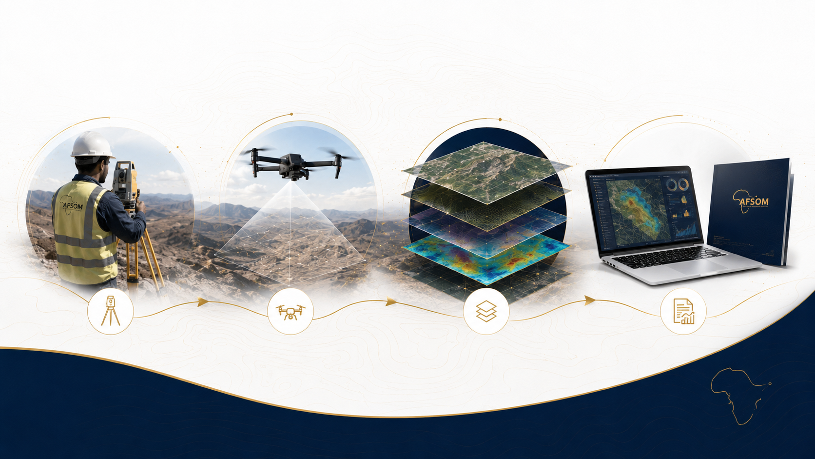
How We Work
A structured approach delivering reliable results at every stage.
Scope and Structure Definition
We define the report scope, structure, and content requirements with the client, ensuring alignment with intended use and audience.
Data Compilation and Review
All relevant project data is gathered, reviewed for completeness and quality, and organized for integration into the report.
Analysis and Interpretation
Geological data is analyzed and interpreted to develop the findings, conclusions, and recommendations that form the core of the report.
Report Drafting and Figure Preparation
The report is drafted with clear narrative, supported by professionally prepared maps, figures, tables, and appendices.
Internal Review and Finalization
A senior reviewer checks the report for technical accuracy, logical coherence, and presentation quality before client delivery.
Technology We Use
Technical writing and document production software
Professional document preparation with consistent formatting, cross-referencing, and version control.
GIS and mapping software
Production of report-quality maps, figures, and spatial data visualizations.
Data analysis and statistical software
Geochemical and geological data processing, statistical analysis, and graphical presentation.
3D visualization and modelling tools
Generation of three-dimensional geological figures and cross-sections for report illustration.
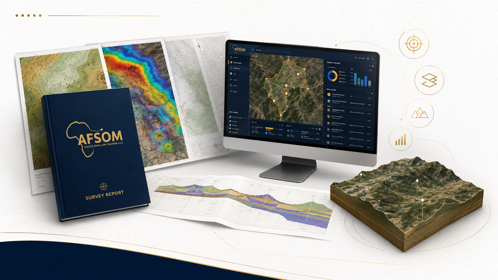
What You Receive
Comprehensive technical report in PDF and editable formats with full table of contents and appendices
Report-quality maps and figures in both embedded and standalone high-resolution formats
Management summary document providing concise overview for executive and investor audiences
Digital data appendices with all supporting datasets, calculations, and reference information
Presentation slide deck summarizing key findings for stakeholder briefings and meetings
Why This Matters
Provides authoritative documentation that supports regulatory submissions and compliance
Enables informed investment and development decisions through clear, well-structured analysis
Enhances credibility with investors, partners, and regulators through professional reporting standards
Creates a permanent technical record that preserves project knowledge and supports future work
Tailored reporting formats ensure that technical information reaches all stakeholders effectively
Discuss This Service
Ready to explore how technical reporting can support your project? Get in touch with our team for a detailed discussion about your requirements.
We respond to all enquiries within two business days.