Topographic Mapping
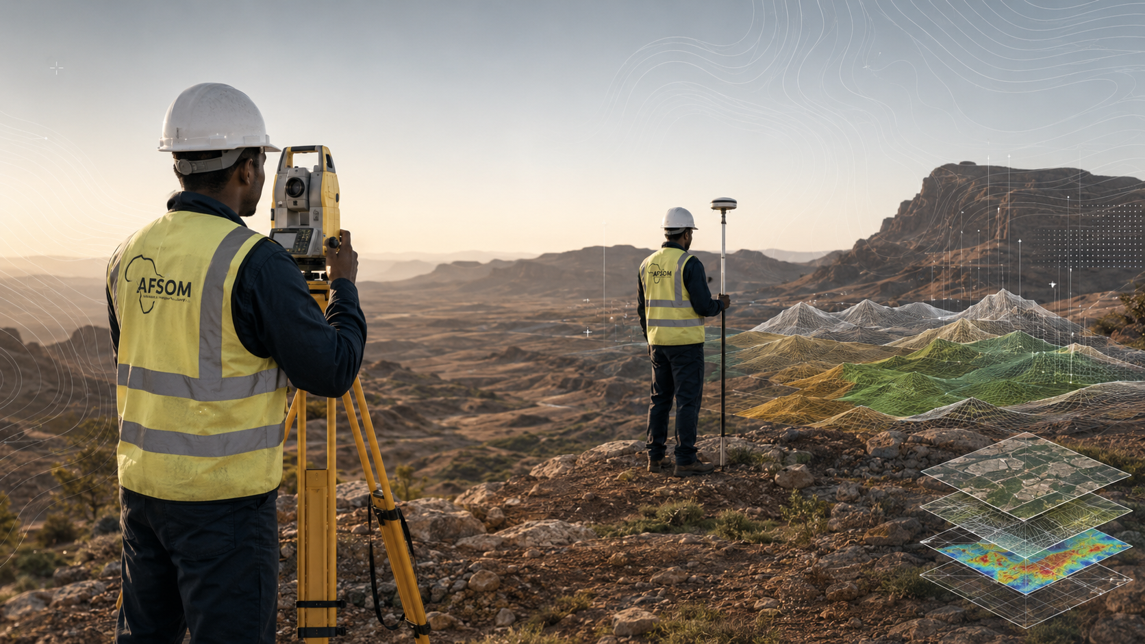
Professional topographic mapping services using GNSS, Total Station, and UAV technology. Contours, digital terrain models, digital elevation models, site layouts, volume calculations, and engineering survey support.
About Topographic Mapping
Accurate topographic data is essential for engineering design, construction planning, resource estimation, and environmental management. AFSOM provides comprehensive topographic mapping services using both traditional survey methods and modern geospatial technology. From regional terrain models to detailed site surveys, our topographic products deliver the precision and reliability that infrastructure, mining, and development projects demand.
Key Service Areas:
- GNSS data capture
- Total Station surveys
- Contours
- Digital Terrain Models
- Digital Elevation Models
- Site layouts
- Volume calculations
- Engineering survey support
The Challenge
Many project sites in Somaliland and the Horn of Africa lack reliable topographic data at the resolution required for detailed engineering and planning work. Using coarse or outdated elevation data can lead to design errors, inaccurate earthwork estimates, drainage problems, and costly construction modifications. Obtaining accurate topographic information requires trained survey crews, calibrated equipment, and systematic data collection and processing procedures.
Our Solution
AFSOM deploys experienced survey teams equipped with GNSS receivers, Total Stations, and UAV platforms to capture high-resolution topographic data tailored to each project's accuracy requirements. We process field measurements using industry-standard software to produce contours, digital terrain models, and site plans that form a reliable foundation for engineering design and volumetric analysis. Our quality control procedures ensure that delivered products meet or exceed project specifications.
What We Cover
Establishment of survey control networks using high-precision GNSS observations
Detailed topographic pickup using Total Station and GNSS rover techniques
UAV-based photogrammetric surveys for medium to large area coverage with high point density
Contour generation at specified intervals with breakline enforcement for terrain definition
Production of Digital Terrain Models and Digital Elevation Models in standard industry formats
Site layout plans showing built features, boundaries, access routes, and key infrastructure
Volume calculations for stockpiles, excavations, cut-and-fill, and resource estimation
Engineering survey support including setting-out data, as-built surveys, and deformation monitoring
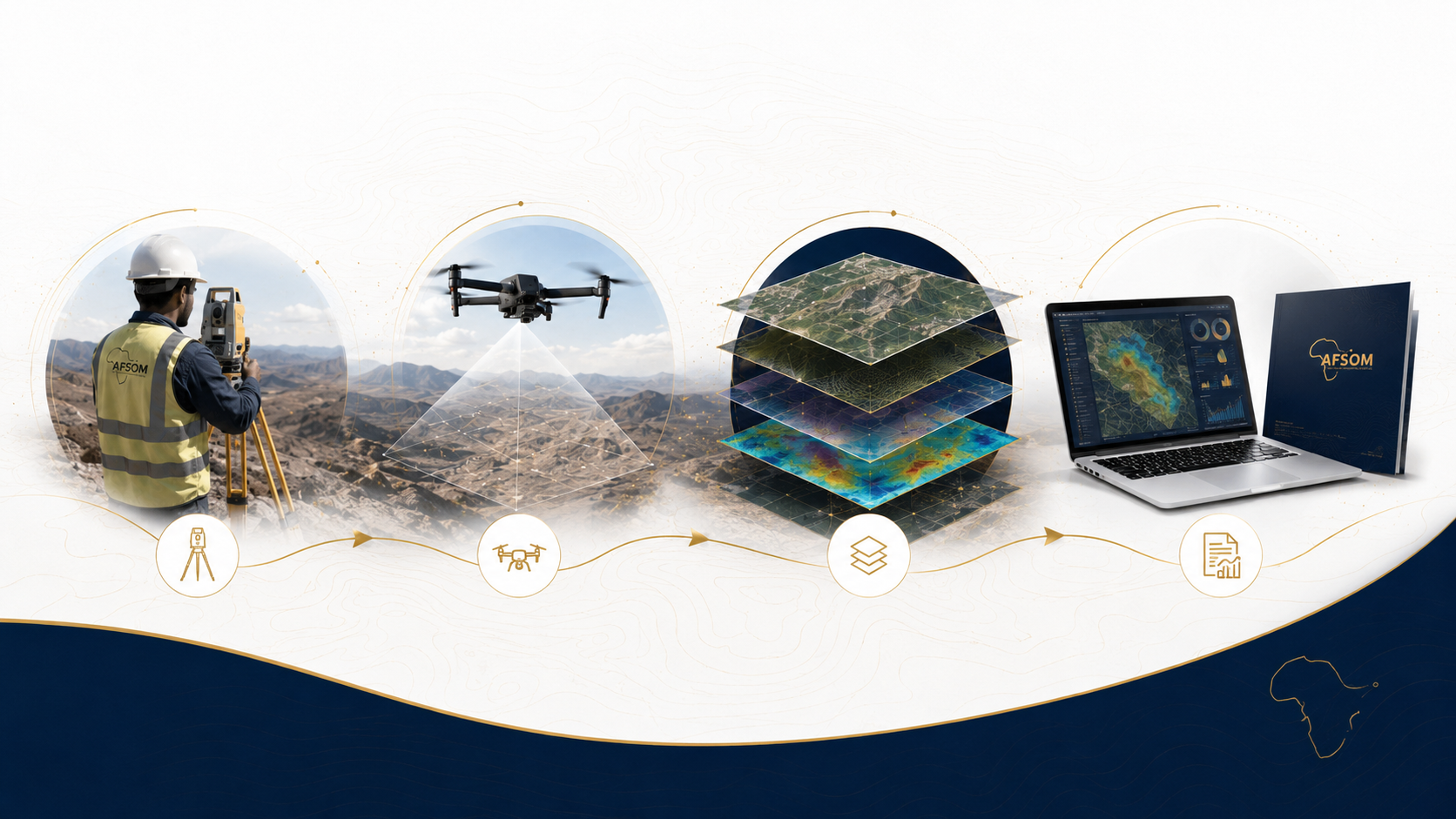
How We Work
A structured approach delivering reliable results at every stage.
Survey Planning and Control Establishment
We design the survey methodology, establish primary control points, and ensure geodetic reference to the project coordinate system.
Field Data Capture
Survey crews collect topographic data using GNSS, Total Station, and UAV platforms according to the specified accuracy and density requirements.
Data Processing and Adjustment
Raw survey observations are downloaded, processed, and adjusted to produce a validated point dataset with verified coordinate accuracy.
Surface Modelling and Contouring
Validated point data is used to generate digital terrain surfaces, with contours interpolated at project-specified intervals.
Final Deliverable Production
Topographic maps, terrain models, and survey reports are compiled, quality-checked, and delivered in formats compatible with client engineering and GIS systems.
Technology We Use
GNSS receivers
High-precision satellite positioning for control establishment and topographic data capture in open terrain.
Total Station instruments
High-accuracy angle and distance measurement for detailed site surveys and areas with limited sky visibility.
UAV with photogrammetry payload
Aerial survey platform for rapid, high-density terrain data capture over medium to large areas.
Survey processing software
GNSS baseline processing, network adjustment, and coordinate transformation computations.
Terrain modelling software
Surface generation, contour interpolation, and volumetric calculation for topographic deliverables.
What You Receive
Digital Terrain Model in industry-standard formats compatible with engineering and GIS software
Topographic contour map at project-specified intervals with labeled elevation values
Site layout plan showing survey control, measured features, and topographic detail
Survey control report documenting network design, observation methods, and coordinate quality
Volume calculation report with methodology, assumptions, and uncertainty estimates
Point cloud dataset from photogrammetric or ground-based survey for client use in detailed analysis
Why This Matters
Provides accurate elevation data that reduces design errors and construction rework
Enables reliable earthwork and resource volume estimation for project costing and planning
Supports hydrological modelling, drainage design, and flood risk assessment
Forms a baseline for construction monitoring, as-built verification, and deformation studies
Integrates seamlessly with geological, geotechnical, and infrastructure datasets in GIS
Discuss This Service
Ready to explore how topographic mapping can support your project? Get in touch with our team for a detailed discussion about your requirements.
We respond to all enquiries within two business days.